Although less technical than some of our other peaks, Mount Edgar Thomson was one of the most physically demanding summit days on the trip, and our first real mountain.
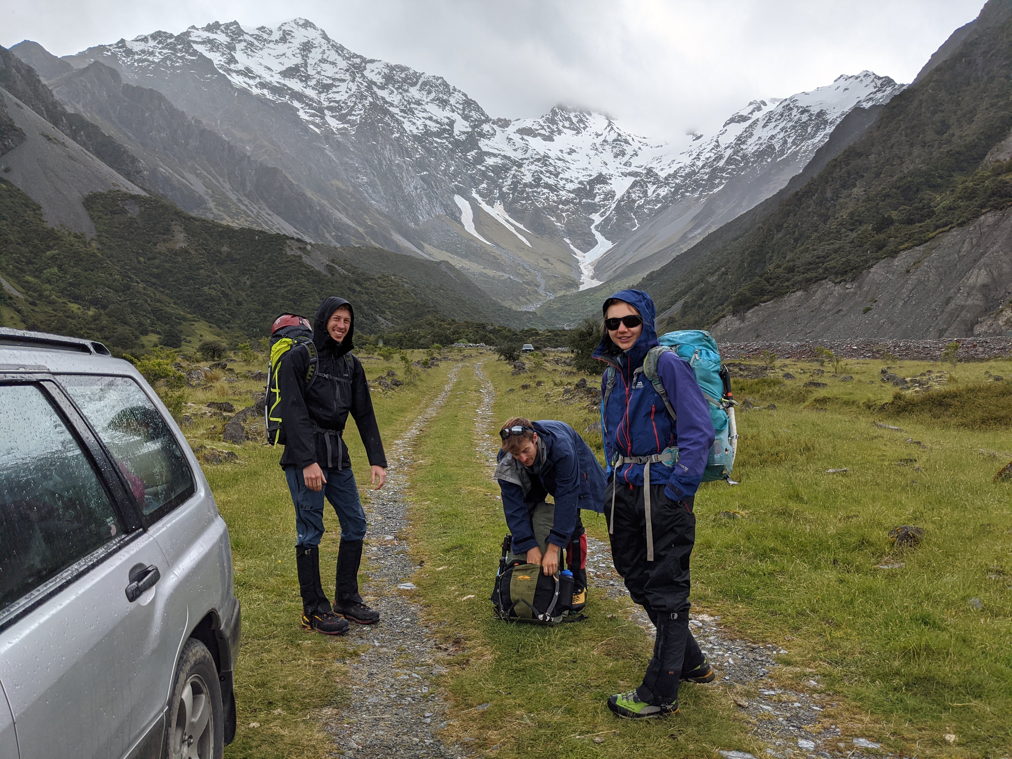
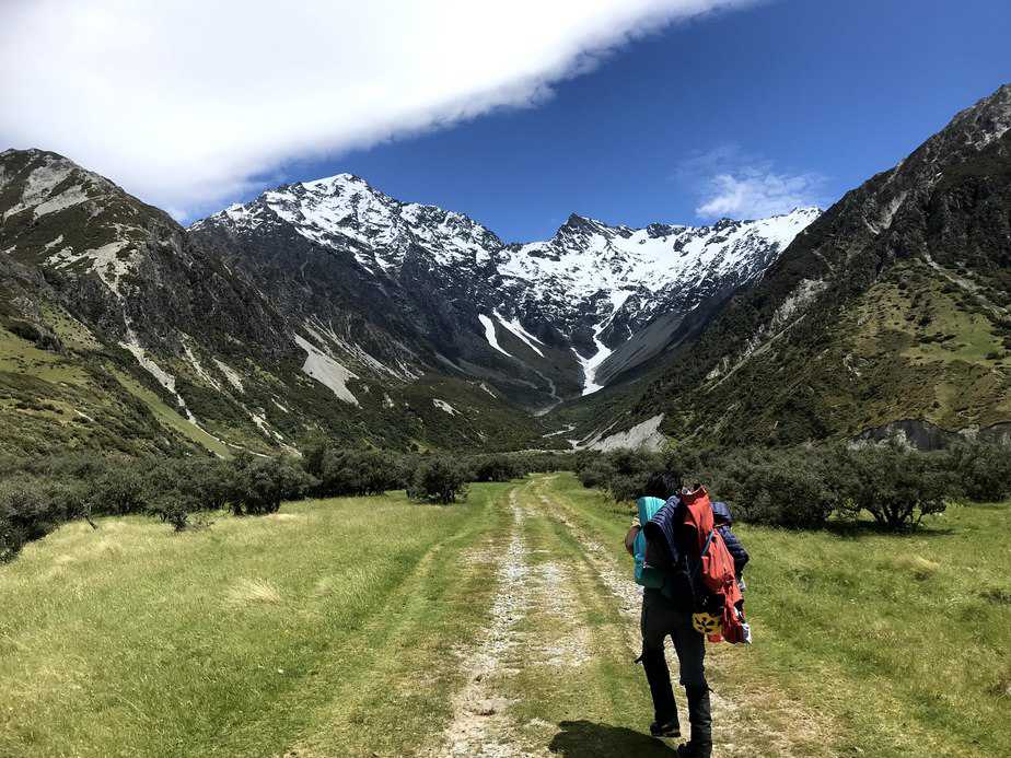
After the epic on the Grand Traverse I was keen for more of a physical challenge than a committing technical route. Mount Edgar Thomson looked like a great option before the course because it was easy to access from the highway, didn’t require ropes and would hopefully give us the opportunity to bivy overnight in an alpine environment. Our plan was to climb Edgar Thomson via the Hoophorn Stream, find a spot the bivy overnight on or near the ridge between Edgar Thomson and Jamieson Saddle, and then return back to our car the next day via the Birch Hill Stream.

Our first view of the mountain was a little intimidating, looming 1700m above our car and including a number of rocky pinnacles on the way to the summit. We talked to a Swedish couple the night we’d arrived who had turned around while attempting the same route that day. They’d wasted a lot of time bushbashing up from the stream and told us the snow higher up was really deep and slushy. That, along with the forcast of 3 mm of precipitation on the first day wasn’t too promising, but the second day looked clearer and the forecast was only for ‘gentle breeze’ over the whole period so it was worth a shot! We did confirm before we left that we would all be willing to turn back at any point if it didn’t look safe.
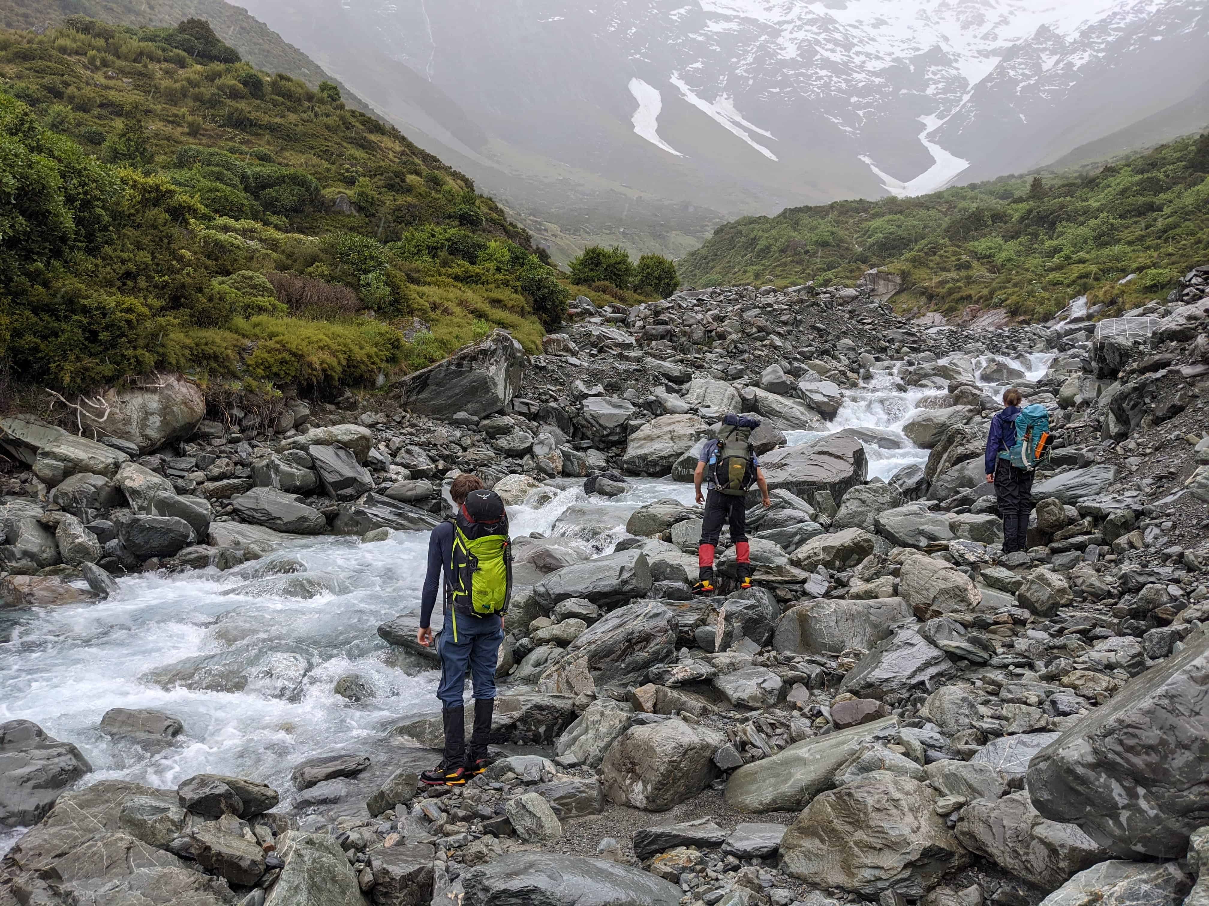
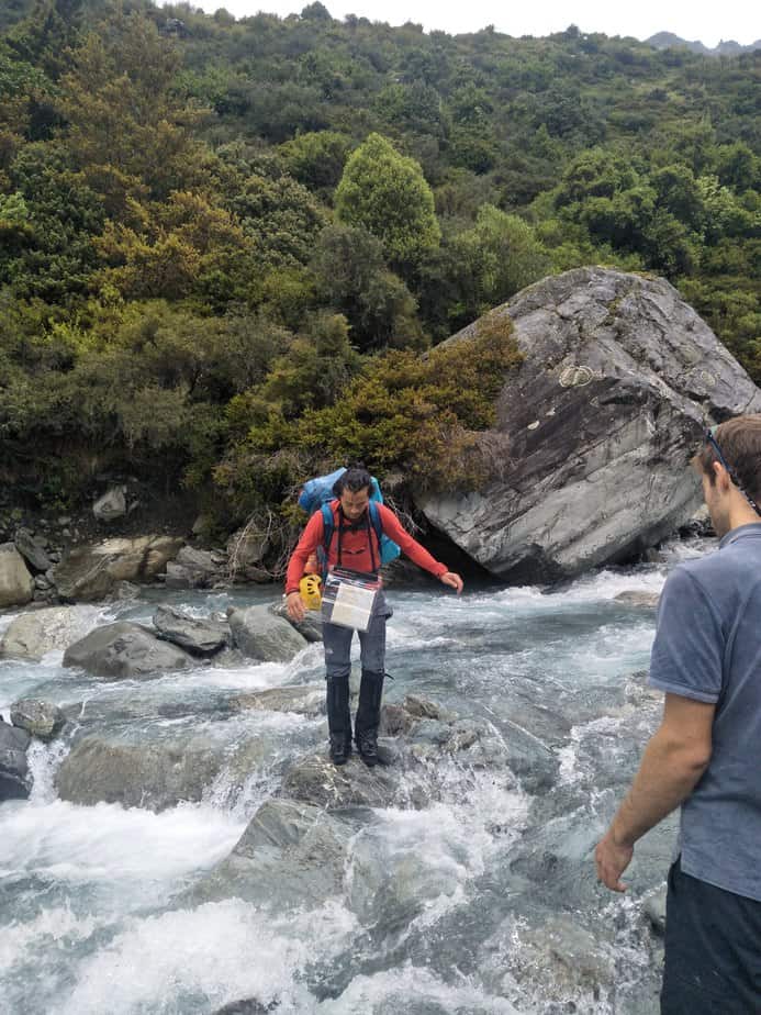
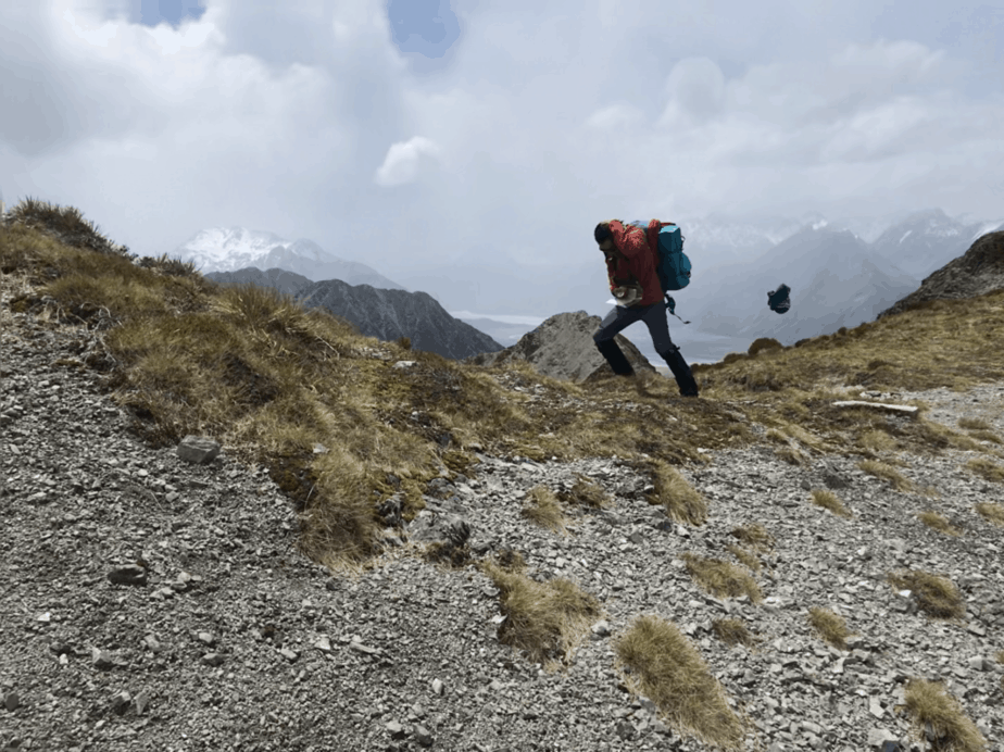
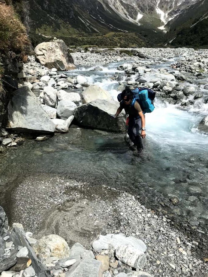
Not learning our lesson from the Grand Traverse, we all slept in the next morning and were ready to leave the car with an alpine start of 10:30 am. We were determined to avoid the heinous bushbashing we were told about, which required us to follow the banks of the Hoophorn Stream, swapping from one side to the other twice as one of the banks narrowed to nothing. The stream had a decent follow after the recent rains and it was difficult to find a route from one side to the other while keeping our feet dry. However, with some searching, impressively waterproof mountaineering boots and the help of gaiters (which I was totally won over by on this trip), our feet remained more or less un-sodden.
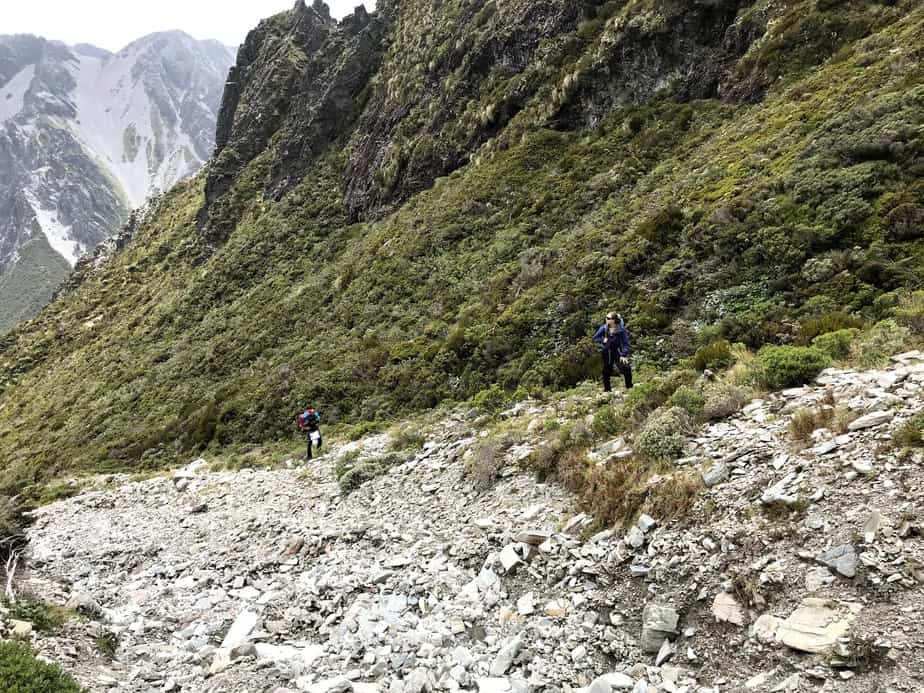
From the Hoophorn Stream it was a relatively straightforward scramble up a creek to the saddle below the East Ridge of Edgar Thomson where we stopped for lunch. We actually sheltered a little to the lee side of the saddle, as the ‘gentle breeze’ we were promised turned out to be strong enough to blow Jeffrey’s beanie right off his head, sending it horizontally at high speed. Luckily it flew directly into the chest of Ash who was standing 5m away and caught it.

After lunch we started the 950m climb up the East Ridge, getting our ice axes out at the start of the steep snow in case we needed to self arrest. Fairly early on we found the deep slush we were told about, and regularly stepped through until our knees or thighs. During a rest break Ash experienced this painfully as one of his legs fell into to snow, the crampon on the other foot piercing his calf through his gaiter and pants. The wound was narrow but deep, and Ash enjoyed pointing out where you could see his fat tissue through the hole. After inspecting it Ash assured us he was keen to keep going, so we continued up the ridge.
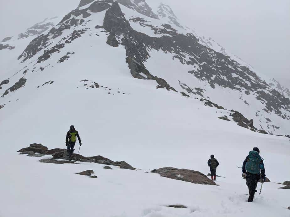

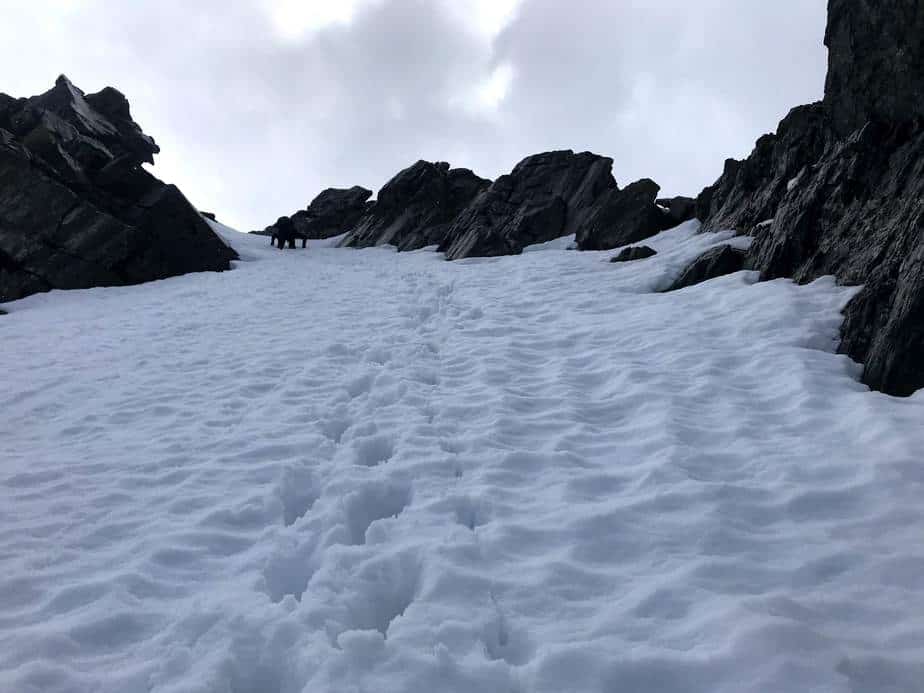
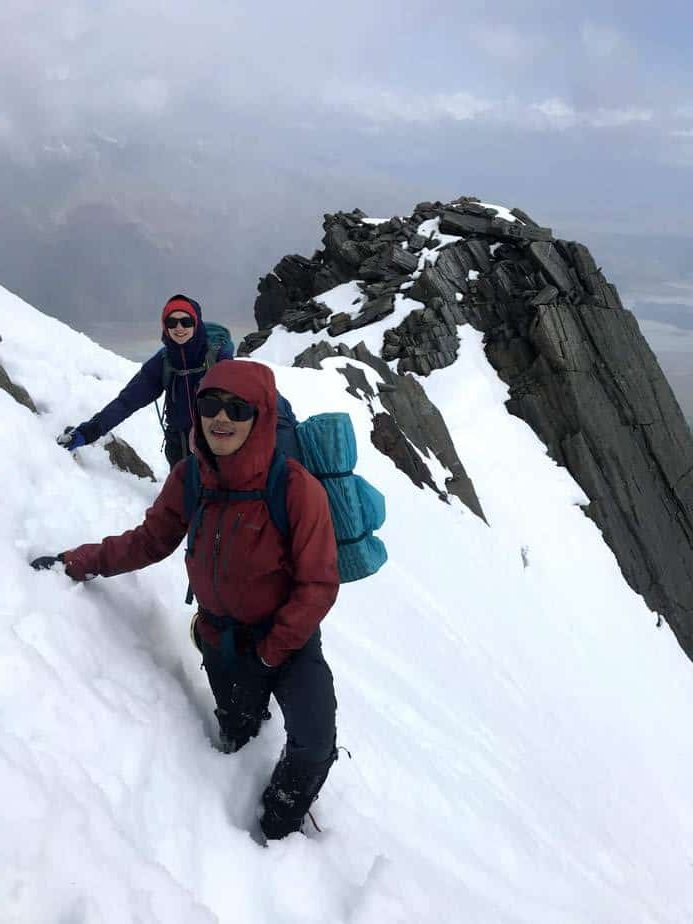
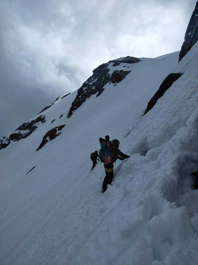
It had between intermittently but lightly raining on us the the whole day up until this point and from here it continued until near the summit, although now it was hard to distinguish between rain and snow. The snow slopes got steeper as we ascended, and it was punishing work in the deep snow. We took turns leading the way, as progress was a lot easier following in someone else’s footsteps, and the length of breaks was kept to a minimum to keep warm.

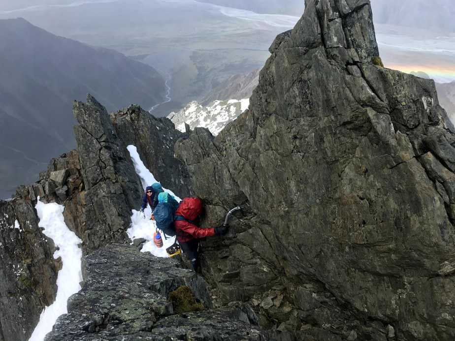
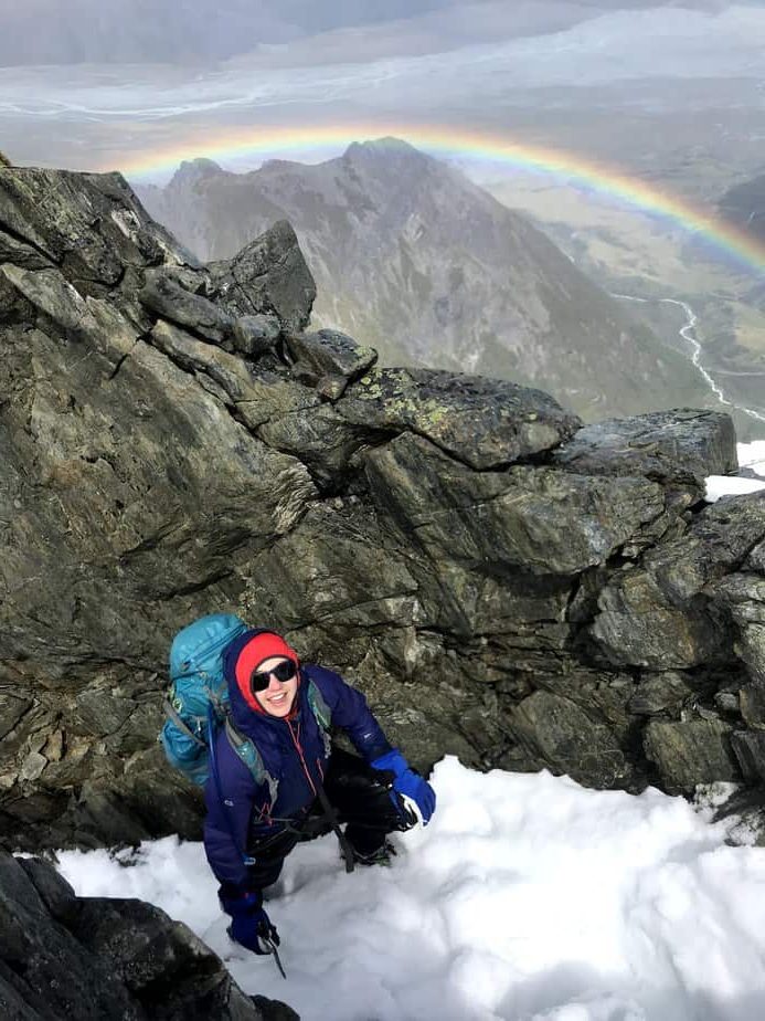
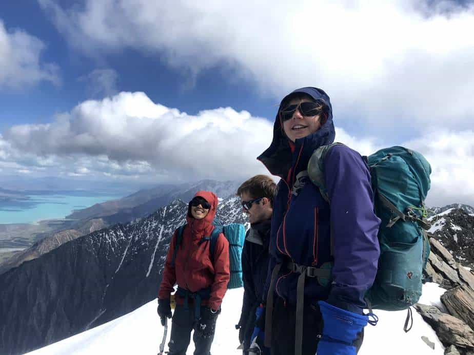
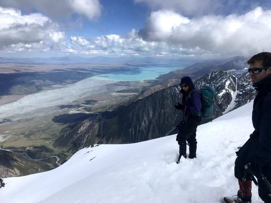
We were however enjoying the interesting display of mountain weather. The northerly winds varied wildly depending on the topography of where we were at the time, so we tried to keep to the more sheltered south side of the ridge, and were treated to a bright double rainbow directly behind us. The skies were clear towards the glacial blue of Lake Pukaki, but on the other side our views of Mt Cook were obscured by a mass of dark clouds forming over that range, quickly dissipating and dropping the occasional snow or rain shower as they were blown over us.
In the last few hundred metres before the summit fatigue in our leg muscles really started to set in, but we kept a slow and steady pace on to the summit and the promise of a decent food break. The lack of breaks was also influenced by my desire the keep moving to stay warm. While this was working fine for me, we found out later that Jeffrey most likely had mild hypothermia by this point. We probably could have done better with focusing on how others in the group were feeling and addressing that, instead of assuming everyone was having a similar experience. (Tip: softshell alpine pants quickly get soaked through in thigh-deep wet snow).
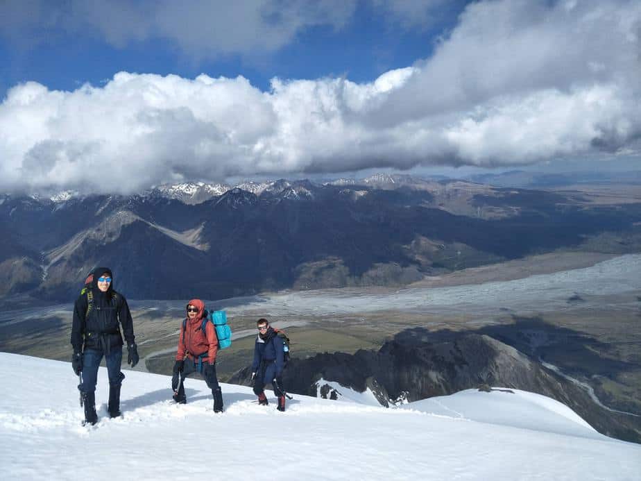
We did make it to the summit though at 5:30 pm and enjoyed a brief period of elation and beautiful views before realising how cold we were. It was far too exposed to wind on the summit to stay there long so we descended to a slightly sheltered spot, did our best to warm up our cold fingers and wolfed down as much sugar, salt and calories as we could manage.
At this point our dreams of an alpine bivy were looking more reasonably like a sub-alpine bivy to avoid the wind, so the next section of the route was to traverse the undulating ridge that led to Jamieson saddle. This consisted of more tiring climbing up and down steep snow slopes, mostly avoiding the loose rock on the exposed tops of the jagged ridge line. In one spot the wind was so bad that while waiting for the others, bracing myself against the snow on all fours, I was still getting thrown into the boulder next to me by gusts (100+ kph?).
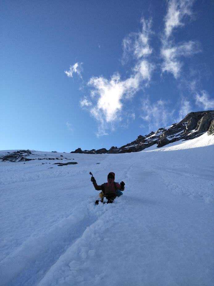
From this boulder at the end of the ridge though we were rewarded but what was the highlight of the day for me. Going down first I discovered that the steep, soft snow was perfect for bum-sliding down! And the other three followed down the tracks. We managed to accumulate some decent speed this way, controlling the braking with our feet and holding our ice axes ready to self arrest if it ever got too scary or out of control (once or twice). Racing each other, we probably lost 300-400 vertical metres this way, and it was definitely a lot more enjoyable than gaining that altitude.
Lower down the gullies, the snow gave way to an awkward mixture of melting snow and scree, with pockets of air underneath. It was here that Jeffrey lost his first helmet of the trip (stay tuned for Part II: Mt Avalanche). All of us were stumbling a bit here but Jeffrey, with more climbing than hiking experience, had the hardest time. After being convinced earlier not to slide down on his lightweight helmet to keep his bum warm, he attached it hanging down below his pack, where it inevitably met with a crunchy end as his bum tried to make contact with the scree.
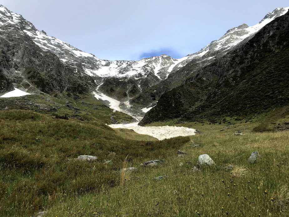
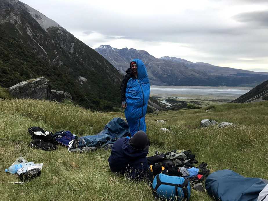
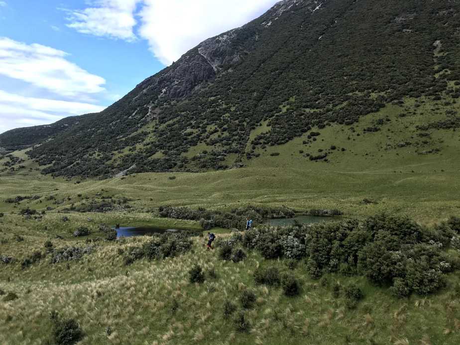
We made camp that night at sunset (9:30 pm, NZ summer is great), on a lovely flat patch of grass next to the Birch Hill Stream, 1400 m below the summit of Edgar Thomson. The next day was easy walking back to the road, with some fun rock hopping, colourful creekside flowers and a bunch of very thorny bushes thrown in. At the road Jeffrey and I decided to continue walking to the car, while Ash and Jenny would try to get a hitch for the 3.5 km. Unfortunately most of the traffic heading towards Mt Cook Village were overseas tourists in expensive hire cars, and the two of them eventually followed us with the road walking. As had become tradition in the NZ crew, Jeff and I took that time to discuss what would be in our next EpicTV order, which would of course include a new helmet. We also reflected on what we had learnt after the Grand Traverse and Edgar Thomson, and with us especially how our abilities complimented each other – Jeff feeling a lot more confident than me on the technical climbing on the Grand Traverse, and vice versa on long day and unstable ground of Edgar Thomson.


We all got back to the car around 11 am and enjoyed a delightful and well deserved lunch, feeling pretty proud of our achievement the previous day.